The Fish + Forest Project based out of McGill University in Montreal, Canada was created to look at the disappearing habitat of endemic species all over the world. They have a special focus on highly endemic fishes, as they are easily affected by human encroachment, deforestation, mining, agriculture and global warming. Using remote sensing and geographic information systems we can track forest and aquatic habitat changes over time, and visualize how habitat is shrinking or disappearing completely.
Besides larger global studies, they focus on rare and well known species all over the world to show the plight of their habitats as individual case studies.
Their website provides more in terms of background;
Fish + Forest Project wrote:A river in peril - the Rio Xingú rapids
The Belo Monte hydroelectric dam, the second largest hydroelectric project on the planet, will significantly change the Xingú river, using up to 80% of its water to power the turbines, significantly reducing the flow of one of Brazil’s most diverse and spectacular rivers. Rheophile fish species, especially catfishes of the family Loricaridae, found only in the rapids of the Rio Xingú may not survive the human encroachment to their habitat. Sciencists have not yet described many of the endemic species already under threat in the river. How will the mega-project affect the river’s ecosystem, and the forests along the banks?
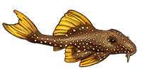
Many of the river’s endemic species such as , , , , , and many others now face a significant loss of habitat, with the looming threat of extinction for those species found only below the dam, or in the flooded reservoir above it.
Vast sections, including 400 km2 of untouched forest in the region will be lost in the initial stage of construction alone. INPA (Instituto Nacional de Pesquisas da Amazônia) calculated that during its first 10 years, the Belo Monte-Babaquara dam complex will emit 11.2 million tonnes of carbon dioxide (CO2) equivalent (CDE) and nearly an additional tonne CDE during the construction phase.
Using satellite images and data collected on the ground we plan to track the change and how it is affecting the river.


